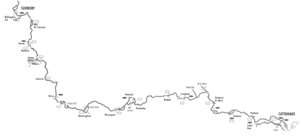
The Environment Agency (EA) is the navigation authority for the section of the Stour that runs from Brundon Mill (upstream of Sudbury) to Cattawade (near Manningtree). Through navigation is possible for all types of craft from Sudbury to Great Henny, travelling through Great Cornard Lock. It is ideally suited to lighter craft, such as canoes and kayaks, that can be portaged between the various structures along the Navigation. However, it is possible to navigate larger craft using the restored locks.
Unpowered craft (i.e. those that are paddled, rowed or sailed) are permitted to travel the whole length of the Stour Navigation, from Brundon Mill to Cattawade. Powered craft, with certain specified exceptions such as the River Stour Trust trip boats, are restricted to the stretch between Ballingdon Bridge and Henny Street. The speed limit is 4 mph. CLICK HERE to read the Anglian Navigation Byelaws.
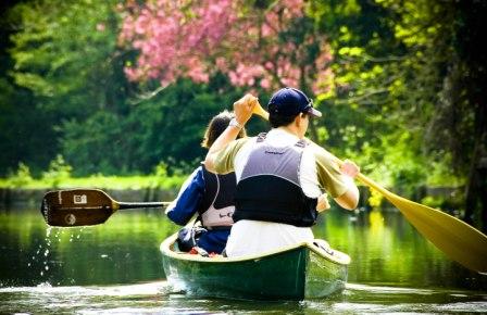
PADDLING THE RIVER STOUR
All craft must be registered to take to the water on any part of the Inland Waterway network of England (canals, rivers, navigations).
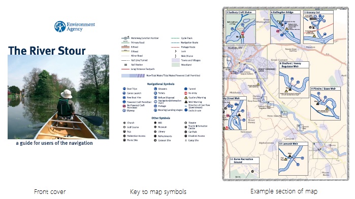
RIVER STOUR NAVIGATION GUIDE
An indispensable guide printed on damp proof paper with map of the entire navigable route, details and locations of the portages, launching sites, riverside campsite and contact information for relevant organisations). Size A5 when folded but opens up to size A2.
EA INCIDENT HOTLINE 0800 80 70 60 (24-hr)
- damage or danger to the natural environment
- pollution to water or land
- poaching or illegal fishing
- dead fish or fish gasping for air
- main rivers blocked by a vehicle or fallen tree causing risk of flooding
- unusual changes in river flow
- flooding from any river, stream, canal, natural spring or the sea
- incidents at Environment Agency-regulated waste sites
- illegal removals from watercourses
- collapsed or badly damaged river or canal banks
- Further information on types of incidents and reporting them – click here.

BUT WHERE AM I?
Being able to provide precise location information is vital. A simple solution is what3words. It can pinpoint a 3m x 3m square anywhere in the world and provide a 3 word address to share the location! The EA use this system – find out more!
Leptospirosis (Weil’s Disease)
It is important that all river users are familiar with the symptoms of this infection, which are similar to those of influenza (temperature, muscle aches and nausea). Leptospira bacteria is often carried by rats and excreted in their urine, which contaminates the waterways. Infection is more likely in slow-moving or stagnant water in areas where agriculture and rodents mix but exposure can be heightened through some activities e.g. angling where minor cuts and nicks are common; or swimming where some water will almost inevitably enter the mouth.
- Be aware that activities that can cause open wounds or that take place near the water’s edge where rat urine is more likely to be found increase the risk of contracting the disease.
- Do not swallow river water
- Avoid capsize drill or rolling in stagnant or slow-moving water
- Wash your hands before eating
- Cover minor scratches, cuts and abrasions on exposed parts of the body with waterproof plasters
- Where possible, wash or shower after taking part in water sports and riverside activities
- Consult your doctor if you feel ill after coming into contact with water anywhere near or in the river.
